Maps, Portraits, Poland, East Prussia, Pommerania, Baltic Sea, Memel, King Friedrich Wilhelm I. of Prussia, Seutter
"Borussiae Regnum sub fortissimo Tutamine et justissimo Regimine Serenissimi et Potentissimi Principis Friderici Wilhelmi latissimis inerementis efflorescens cum adjacentib. Regionibus mappa Geographica delineatum Cura et sumtibus Matth. Seuteri"
Copper etching with original hand coloring.
Published by Matthaeus Seutter.
Augsburg, ca. 1740
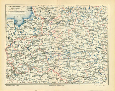
Map shows the former East Prussi including parts of Pommerania in the West and along the Baltic Sea coast up to Memel (Klaipeda).
Map has a very decorative and ornate title cartouche with portrait of King Friedrich Wilhelm I. of Prussia. Within the cartouche are depicted two of Friedrich Wilhelm's focusses: He was strongly mercantilistic, which is depicted by ships being loaded with all kinds of merchandise and his solders, shown on the left of cartouche.
A very special feature of this map, which makes it historically interesting and special, is the inset map in the upper left corner: Almost totally forgotten is the fact, that Prussia, from 1707 to 1848 owned an exclave in Switzerland: The Principality of Neufchâtel (Neuenburg), which had an exotic historical background, too lengthy to explain here. It was the only royal corner, ca. 40 by 20 Km in size, in otherwise strictly republican Switzerland. A note of exotic distinction for this map!
Original antique print
Good condition.A bit of age browning in margins. Small repair on lower margin edge.
Normal signs of age and use.
48.7 x 57 cm (ca. 19.2 x 22.4")
Keywords:
Frederick William I ; "Soldier King" ; Soldatenkönig; king in Prussia and elector of Brandenburg; prince of Neuchâtel. Fürstentum Neuenburg; Houses of Orange and Nassau; Haus Oranien-Nassau; allegorical scene of his coronation; Wappen; Coat of Arms; justice interior design, wall decoration, ideas, idea, gift ideas, present, vintage, charming, special, decoration, home interior, living room design