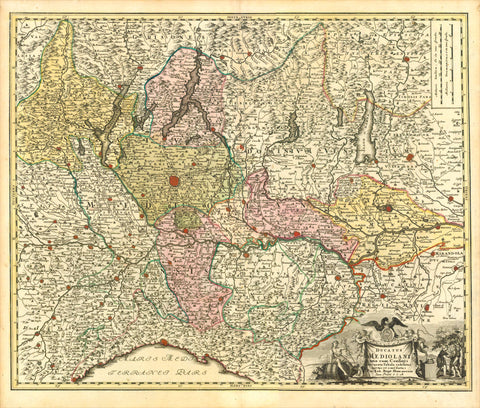
Maps, Switzerland, Black Forest, Lake Geneva, Bormio, Piemonte, Aa
"La Suisse suivant les Nouvelles Observations de Messrs. de l'Akademie Royal des Sciences, etc...."
Copper engraving map by Pieter van der Aa (1659-1733) from "Ouresiphoites Helveticus, sive itinera per Hevetiae Alpinas regiones" published 1723.
Almost in the center of the map is Zug On the left side is Lake Geneva and on the right is Bormio. At the top of the map is the Black Forest and Fuerstenberg. In the south is Biella in the Piemonte.
Map has several folds to fit original book size. Lower right margin has
been added. Repair in left margin on fold line. Lower margin widened.
Map image: 22 x 29 cm (8.6 x 11.2")
Pieter van der Aa was a Dutch publisher best known for preparing maps and atlases. Some of his most popular maps were of the African continent, detailing locations such as Morocco and Madagascar.
keywords: Lake Geneva; lac Léman; lac de Genève; Lago Lemano; Genfersee; Lai da Genevra; Alps, Switzerland; France; Western Europe; Rhône; Vaud, Geneva; Valais; Haute-Savoie; Fuerstenberg
interior design, wall decoration, ideas, idea, gift ideas, present, vintage, charming, special, decoration, home interior, living room design