Maps, Italy, Southern Italy, Ionian Sea, coins, medals, Weigel
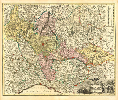
"Magnae Graeciae Descriptio"
Historic map showing Southern Italy, where antique Greeks began to settle in the 8th century BC. The Greeks brought along with them the Hellenic civilization, which was consequently picked up and further developed by the Romans and which is one of the very important cradles of Western Culture and Civilazation. Of Sicily we see only the northern coastline. The only city shown is Messina. Well defined are the Aeolian Islands (Liparische Inseln). On right side: Coastline of Albania and part of Greece. Bunches of coins and medals are held by angels in the Thyrenian and in the Ionian Sea.
Type of print. Copper etching
Color: Original hand coloring
Author: Samuel Faber (1657-1716)
Publisher: Christoph Weigel (1654-1725)
Published: Nuremberg, ca. 1720
Original antique print
Edition: Weigel re-issued "Atlas Scholastichodoeporicus" which Faber originally published in 1716.
Condition: Centerfold has been reenforced. Map is spotty in margins. Repairs also in map and margins. Traces of age and use. General condition: Good.
31,3 x 40 cm (ca. 12.3 x 15.7")