Maps, Germany, Wetzlar, Speyer, Spier, Rhine, Koblentz, Coblentz, de Wit
Regular price
$460.00
Shipping and Taxes calculated at checkout.
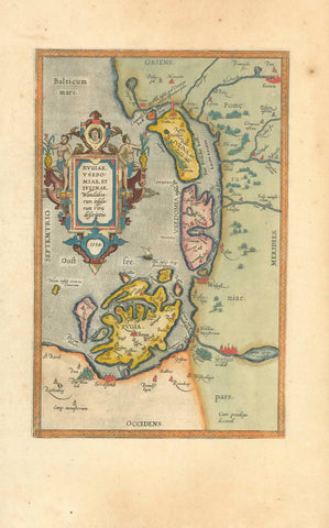
"Archiepiscopatus et Electoratus Moguntini et Adjacentum Regionum, et Landgraviatum...."
Copper engraving map by F. de Wit in the Composite Atlas by Covens and Mortier published from 1721-41.
Reverse side is not printed.
The map extends from Wetzlar in the north to Speyer (Spier) in the south.
In the upper left is part of the Rhine and Coblentz. In the lower right are the Laxt and Kocher Rivers.
Original antique print
Original hand outline colorng. Map image is clean.
Small repairs in upper margin edge on the centerfold and in the lower margin edge on centerfold.
Tiny piece of upper right margin corner is missing. Minimal creasing in margins.
Map image: 48.5 x 59 cm (18.9 x 23")