Preußen, Schlesien, Silesia, Prussia, Paris, 1743  It was the year (1743) of the Prussian-Russian Alliance Treaty, when this map is dated. Prussia was in the middle between the first and the second Silesian War, at the end of which (1745) Austria (to which Silesia belonged) lost Silesia which became a Prussian province thereafter.  Map showing Upper and Lower Silesia during the two Silesian Wars, just briefly before all of Silesia became e Prussian province under King Friedrich II. Of Prussia.

Maps, Germany, Prussia, Silesia

Regular price $150.00 $0.00
Shipping and Taxes calculated at checkout.

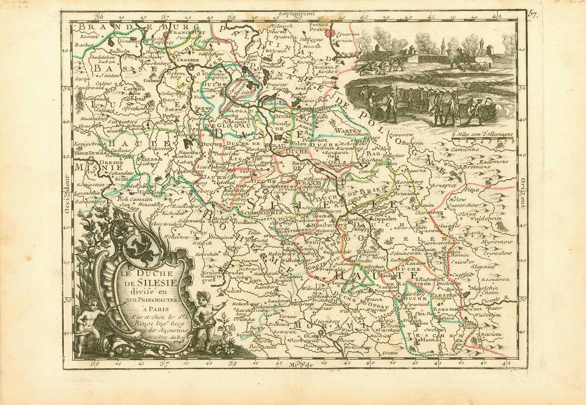
"Le Duché de Silesie divise en XVII Principautees"
(The Duchy of Silesia divided into XVII Principalities)

Copper etching by George Louis Le Rouge (1707-1790)

Published in "L'Empire D'Allemagne - Divise par Cercles"

Paris, 1743

It was the year (1743) of the Prussian-Russian Alliance Treaty, when this map is dated. Prussia was in the middle between the first and the second Silesian War, at the end of which (1745) Austria (to which Silesia belonged) lost Silesia which became a Prussian province thereafter.

Map showing Upper and Lower Silesia during the two Silesian Wars, just briefly before all of Silesia became e Prussian province under King Friedrich II. Of Prussia.

Original antique print  

For a 30% discount enter MAPS30 at checkout

Light age toning and minor spotting in margins. Borderline original hand-color.

Image: 20 x 26,3 cm (ca. 7.8 x 10.3")
Keywords:
Moravia; Bohemia; Jablonka (SE  corner); Radomsko; Poznan; The War of the Austrian Succession (Österreichischer Erbfolgekrieg); Bourbon-Habsburg dynastic conflict; Related conflicts included King George's War, the War of Jenkins' Ear, the First Carnatic War and the First and the Second Silesian Wars.  Silesian Wars (Schlesische Kriege); wars fought between Prussia under King Frederick the Great and Habsburg Austria under Archduchess Maria Theresa for control of the Central European region of Silesia (now in south-western Poland). 
interior design, wall decoration, ideas, idea, gift ideas, present, vintage, charming, special, decoration, home interior, living room design


Share this Product


More from this collection