Maps, South America, North America, Galapagos, Iceland
Regular price
$55.00
Shipping and Taxes calculated at checkout.
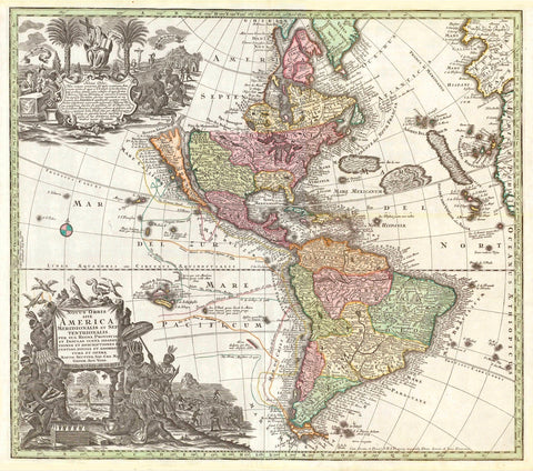
"Amerique du Sud Amerique du Nord"
South America, North America
For a 30% discount enter MAPS30 at chekout
Map of South and North America printed in color ca 1890. Of special interest is the small map in the lower center of France. It shows the size of these two very large continents in comparison to France. In the lower left is a small map inset of the Galapagos Islands. In the upper right is Iceland.
Original antique print
The map has two vertical folds and one horizonal fold to fit original book size.
In the lower left is a part of the margins missing that was bound in the book.
Light natural age toning.
Image: 27 x 40 cm (10.6 x 15.7")