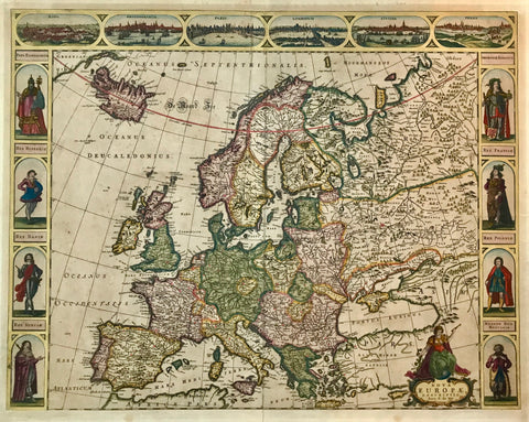
Maps, Europe, Janssonius
"Lumen Historiarum per Occidentem ex conatibus Fran. Haraei Autuerpiae"
Handc-olored copper etching, originally published in a similar version in the Parergon by Abraham Ortelius, Jan Janssonius adopted title and subject for his Atlas Novus, published in 1652. The here available version, slightly amended, was published ca. 1700., in Amsterdam. It has no explanatory text print on reverse side.
The measurements are those of the Janssonius map: 38 x 48 cm (ca.15 x 18.9")
Map is historical retrospect to ancient times. In the north we find England and Ireland and the map's extend near the 53rd parallel into Russia. Western and Central Europe from Portugal to the western shores of what is nowadays Turkey. Northern Africa from the Atlantic to the Mediterranean coastline of Libya. The place names as described in ancient documents by Strabo, Virgil, Caesar and others.
Map has wide margins and is clean. The centerfold in upper part a little wrinkly. Centerfold in lower margin has been repaired. There is a crease running vertically from Prussia, Bohemia, Italy, Sicily to Libyia.
Original antique print
interior design, wall decoration, ideas, idea, gift ideas, present, vintage, charming, special, decoration, home interior, living room design