Maps, Australia, Australian, New Zealand, Pacific Ocean, Sydney, Brisbane, Perth, Great Barrier Reef
Regular price
$120.00
Shipping and Taxes calculated at checkout.
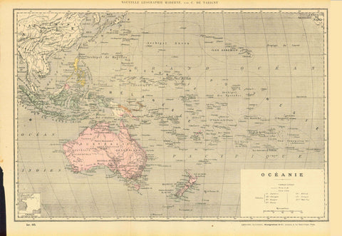
Festland von Australien und benachbarte Inseln"
Australia, Australian, New Zealand, Pacific Ocean, Sydney, Brisbane, Perth, Great Barrier Reef
Map by F. von Stuelpnagel dated 1854.
For a 30% discount enter MAPS30 at chekout
Original outline coloring.
Map shows how little of Australia was settled at this time.
Notice the many details on New Zealand.
In the lower left are the names of the counties in Australia at the time.
Vertical centerfold. Minor signs of age and use
Map image: 31.5 x 39 cm (12.4 x 15.3 ")