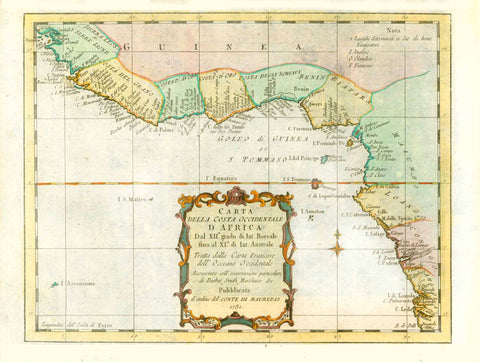
Maps, Africa, West Africa, Senegambia, Senegal, Gambia
Regular price
$75.00
Shipping and Taxes calculated at checkout.
"Senegambien"
(West-Africa)
Africa, Senegambia, Senegal, Gambia
Steel engraving map by Major Radefeld, dated 1850.
For a 30% discount enter MAPS30 at chekout
Original antique print
Original hand outline coloring.
Light, natural age toning.
Map has light browning on margin edges. Minor signs of age and use in margins.
Map image: 19 x 25 cm (7.4 x 9.8")
The Senegambia (Senegaámbi in Wolof), geographical region in West Africa, between the Senegal River in the north and the Gambia River in the south,Wolof, Peul (or Fula), Tukulor (or Toucouleur), Manding, Sereer (or Serer), Soninke, Susu (or Sousou), Joola, Nalu, Baga, Beafada, Bainuk, Bassari